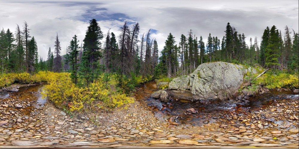
 Rocky Mountains
Rocky Mountains, Colorado
Uploaded Oct 8, 2019 by Jason Buchheim username:odyssey copyright
10,000px by 5,000px, 0.05 Gigapixels
| Unmounted | Acrylic Museum Mount |
| Purchase Prints | Matte | Glossy | Lustre | Metalic | Deep Glossy | Deep Glossy |
| 12" x 24" | | | | | | |
VIEW OPTIONS please select the approximate angle of view of the image
Flat 1° 10° 45° 90° 170°
Sphere 45° 90° 180° 270° 360°
Odyssey Expeditions Panoram.io VR billboard style
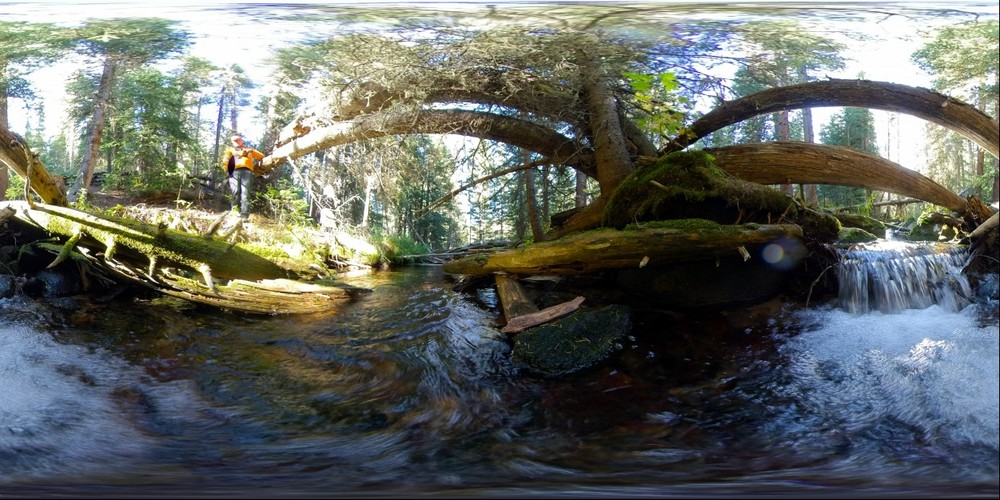 Under a fallen tree, Rocky Mountain National Park
A view under a tree fallen across a stream, Rocky Mountain National Park
Uploaded Oct 8, 2019 by Jason Buchheim username:odyssey copyright
10,000px by 5,000px, 0.05 Gigapixels
| Unmounted | Acrylic Museum Mount |
| Purchase Prints | Matte | Glossy | Lustre | Metalic | Deep Glossy | Deep Glossy |
| 12" x 24" | | | | | | |
VIEW OPTIONS please select the approximate angle of view of the image
Flat 1° 10° 45° 90° 170°
Sphere 45° 90° 180° 270° 360°
Odyssey Expeditions Panoram.io VR billboard style
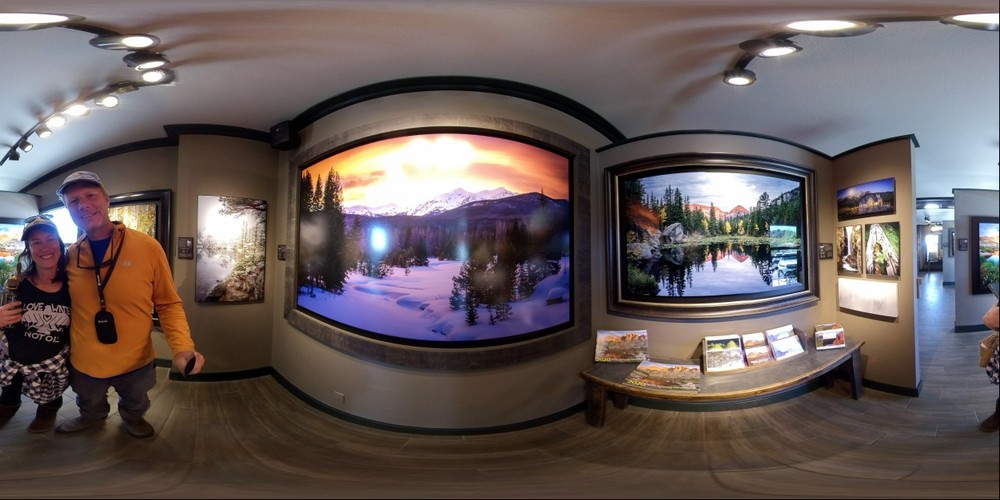 Artist Gallery - Estes Park, Colorado
Admiring the beautiful photos of Rocky Mountain National Park
Uploaded Oct 8, 2019 by Jason Buchheim username:odyssey copyright
10,000px by 5,000px, 0.05 Gigapixels
| Unmounted | Acrylic Museum Mount |
| Purchase Prints | Matte | Glossy | Lustre | Metalic | Deep Glossy | Deep Glossy |
| 12" x 24" | | | | | | |
VIEW OPTIONS please select the approximate angle of view of the image
Flat 1° 10° 45° 90° 170°
Sphere 45° 90° 180° 270° 360°
Odyssey Expeditions Panoram.io VR billboard style
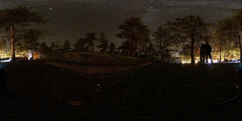 View of the Milky Way from campsite at Rocky Mountain National Park
Taken with Insta360 one x 55 second exposure iso 800
Uploaded Oct 8, 2019 by Jason Buchheim username:odyssey copyright
10,000px by 5,000px, 0.05 Gigapixels
| Unmounted | Acrylic Museum Mount |
| Purchase Prints | Matte | Glossy | Lustre | Metalic | Deep Glossy | Deep Glossy |
| 12" x 24" | | | | | | |
VIEW OPTIONS please select the approximate angle of view of the image
Flat 1° 10° 45° 90° 170°
Sphere 45° 90° 180° 270° 360°
Odyssey Expeditions Panoram.io VR billboard style
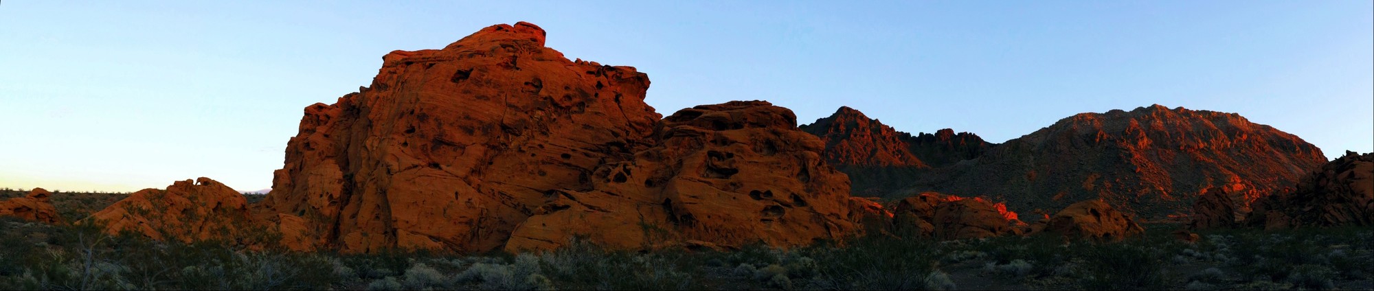 Sunset on Rocks, Lake Mead National Recreation Area
Beautiful Light
Uploaded Nov 23, 2016 by Jason Buchheim username:odyssey copyright
20,418px by 4,331px, 0.09 Gigapixels
| Unmounted | Acrylic Museum Mount |
| Purchase Prints | Matte | Glossy | Lustre | Metalic | Deep Glossy | Deep Glossy |
| 12" x 57" | | | | | | |
VIEW OPTIONS please select the approximate angle of view of the image
Flat 1° 10° 45° 90° 170°
Sphere 45° 90° 180° 270° 360°
Odyssey Expeditions Panoram.io VR billboard style
 Rusty Rocks, Santa Barbara
Rusty intertidal rocks in Santa Barbara, California
Uploaded Nov 8, 2015 by Jason Buchheim username:odyssey copyright
49,250px by 3,625px, 0.18 Gigapixels
| Unmounted | Acrylic Museum Mount |
| Purchase Prints | Matte | Glossy | Lustre | Metalic | Deep Glossy | Deep Glossy |
| 12" x 163" | | | | | | |
VIEW OPTIONS please select the approximate angle of view of the image
Flat 1° 10° 45° 90° 170°
Sphere 45° 90° 180° 270° 360°
Odyssey Expeditions Panoram.io VR billboard style
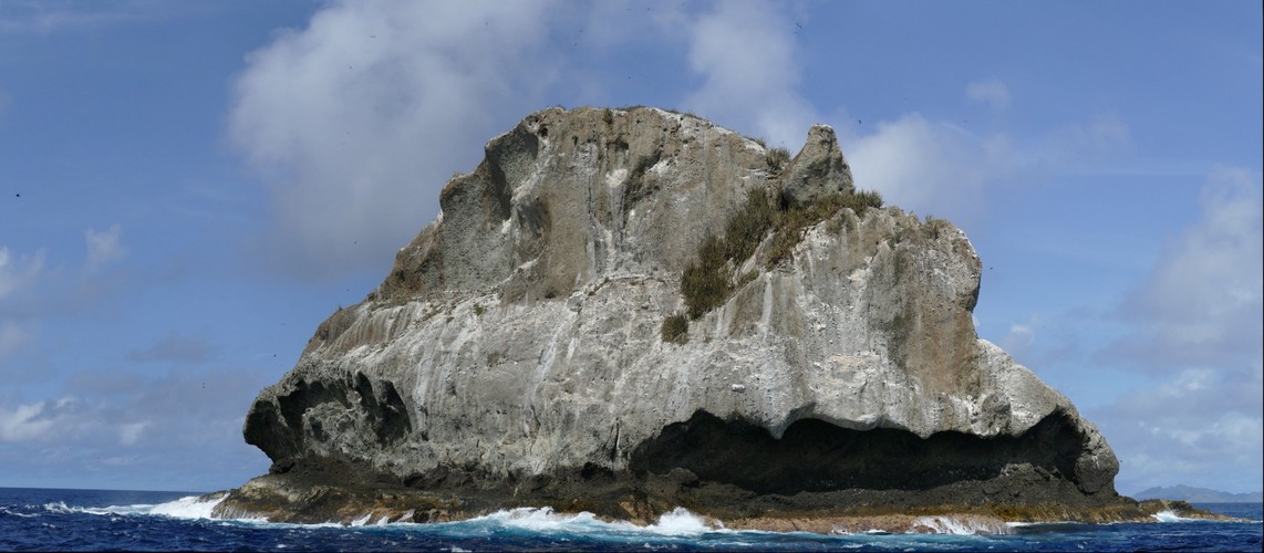 Sail Rock, Grenadines, Caribbean
Sail Rock, five miles east of the Tobogo Cays in St Vincent and the Grenadines, is a spectacular dive site and bird sanctuary. Check out the Brown Boobies and Magnificient Frigate birds here.
Uploaded Nov 5, 2015 by Jason Buchheim username:odyssey copyright
12,023px by 5,266px, 0.06 Gigapixels
| Unmounted | Acrylic Museum Mount |
| Purchase Prints | Matte | Glossy | Lustre | Metalic | Deep Glossy | Deep Glossy |
| 12" x 27" | | | | | | |
VIEW OPTIONS please select the approximate angle of view of the image
Flat 1° 10° 45° 90° 170°
Sphere 45° 90° 180° 270° 360°
Odyssey Expeditions Panoram.io VR billboard style
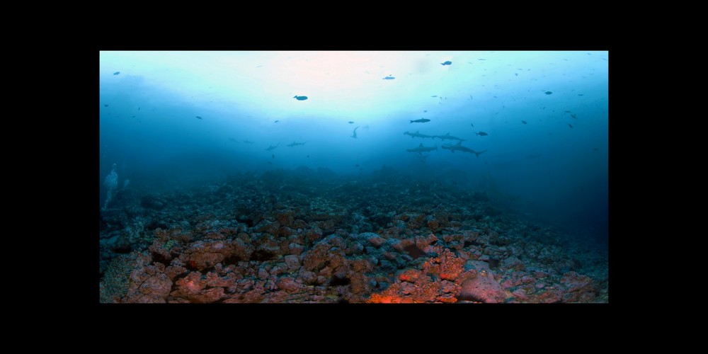 Cocos Sharks for Full Spherical Viewer
Scalloped Hammerhead Sharks swim by Shark Rock, in Cocos Islands, Costa Rica. Best viewed in spherical viewer http://www.3d-360.com/143768
Uploaded Nov 1, 2013 by Jason Buchheim username:odyssey copyright
14,000px by 7,000px, 0.10 Gigapixels
| Unmounted | Acrylic Museum Mount |
| Purchase Prints | Matte | Glossy | Lustre | Metalic | Deep Glossy | Deep Glossy |
| 12" x 24" | | | | | | |
| 18" x 36" | | | | | | |
VIEW OPTIONS please select the approximate angle of view of the image
Flat 1° 10° 45° 90° 170°
Sphere 45° 90° 180° 270° 360°
Odyssey Expeditions Panoram.io VR billboard style
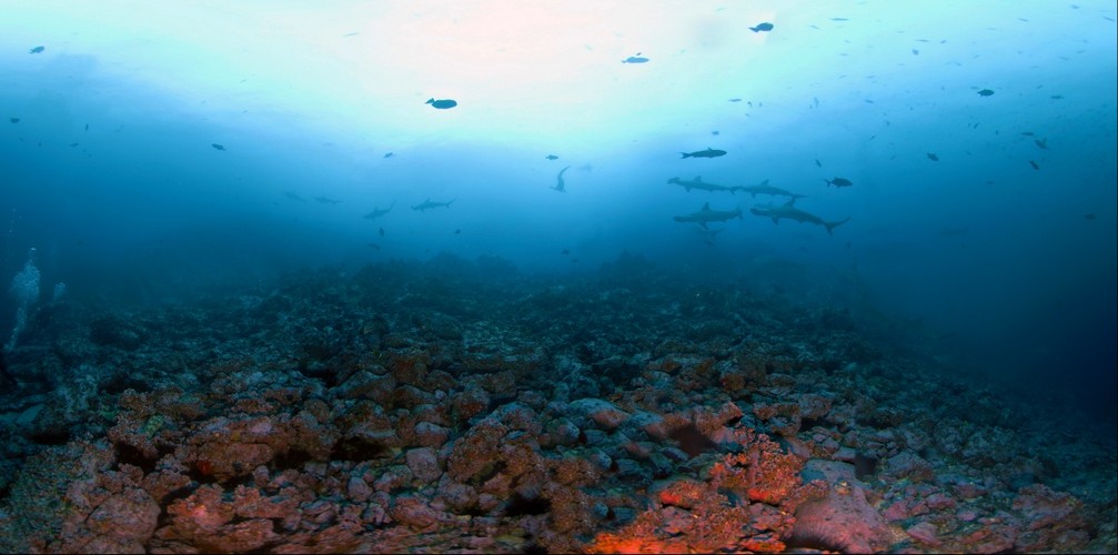 Shark Rock, Cocos Island, Costa Rica
Scalloped Hammerhead sharks put on quite the show for a few lucky divers at Shark Rock, Cocos Island, Costa Rica. Best viewed in spherical viewer here: Best viewed in spherical viewer www.3d-360.com/143768
Uploaded Nov 1, 2013 by Jason Buchheim username:odyssey copyright 2008
10,067px by 5,000px, 0.05 Gigapixels
| Unmounted | Acrylic Museum Mount |
| Purchase Prints | Matte | Glossy | Lustre | Metalic | Deep Glossy | Deep Glossy |
| 12" x 24" | | | | | | |
VIEW OPTIONS please select the approximate angle of view of the image
Flat 1° 10° 45° 90° 170°
Sphere 45° 90° 180° 270° 360°
Odyssey Expeditions Panoram.io VR billboard style
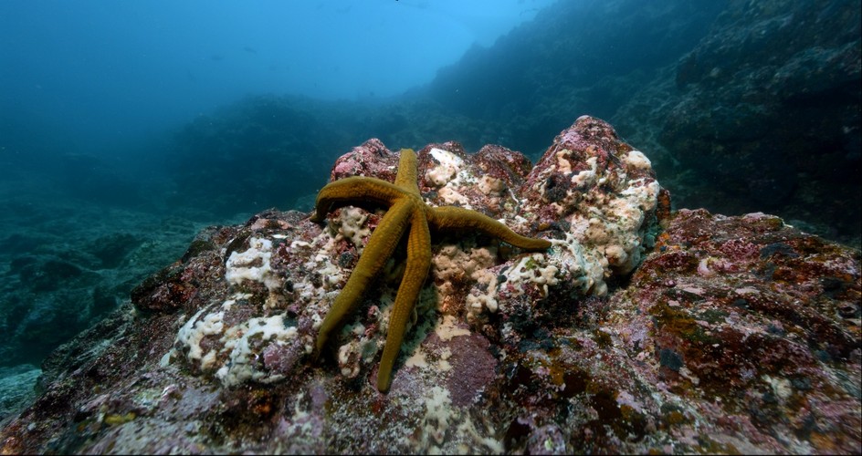 Galapagos Starfish
A starfish travels across a rock in search of prey
Uploaded Sep 10, 2013 by Jason Buchheim username:odyssey copyright
10,058px by 5,325px, 0.05 Gigapixels
| Unmounted | Acrylic Museum Mount |
| Purchase Prints | Matte | Glossy | Lustre | Metalic | Deep Glossy | Deep Glossy |
| 12" x 23" | | | | | | |
VIEW OPTIONS please select the approximate angle of view of the image
Flat 1° 10° 45° 90° 170°
Sphere 45° 90° 180° 270° 360°
Odyssey Expeditions Panoram.io VR billboard style
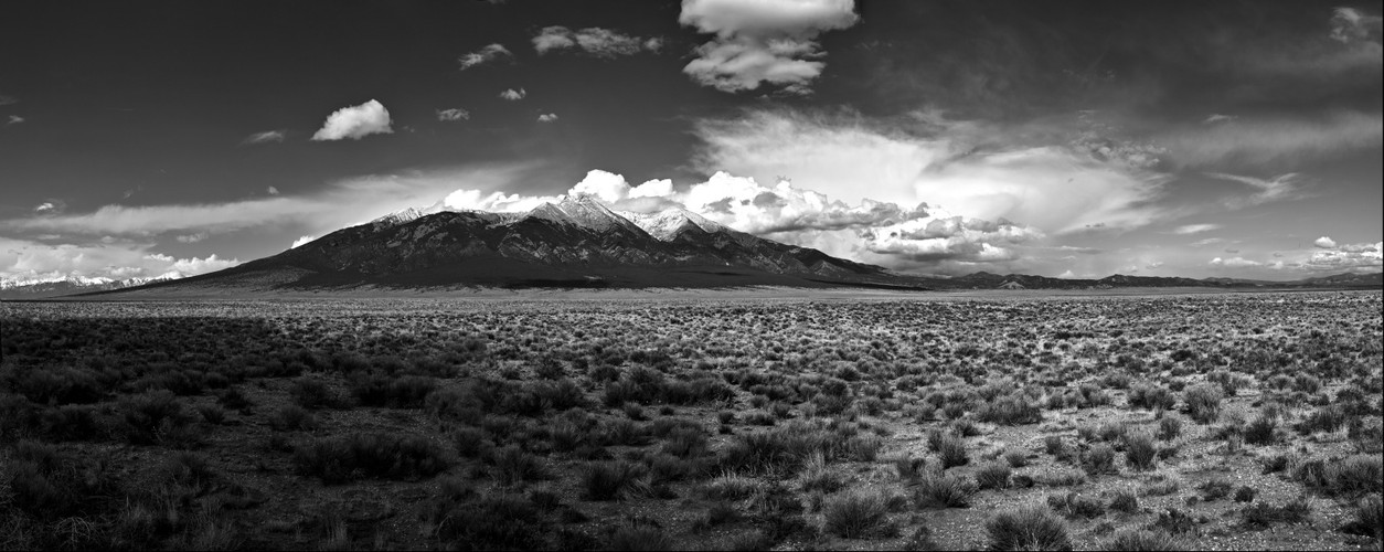 Blanca Peak, Colorado
Blanca Peak is the highest peak of the Sierra Blanca Massif at the southern tip of the Sangre de Cristo Range in the U.S. State of Colorado. It is the fourth highest peak of the Rocky Mountains, and the eighth highest peak in the contiguous United States.
.
.
Geography
.
It is located at the southern end of the Sangre de Cristo Range, a subrange of the larger Sangre de Cristo Mountains, and is the highest peak in both ranges. It marks the common boundary of Huerfano, Costilla and Alamosa counties, approximately 20 miles (32 km) east-northeast of the town of Alamosa. Approximately 15 miles (24 km) to the north-northwest is Great Sand Dunes National Park and Preserve.
.
Blanca Peak is notable not only for its absolute height, but also for its great local relief and dominant position at the end of the range, rising high above the San Luis Valley to the west. For example, it rises nearly 7,000 feet (2,100 m) over the edge of the San Luis Valley in only 6 miles (9.7 km). Blanca is also the third most topographically prominent peak in Colorado; it is separated from the higher peaks in the Sawatch Range by relatively low Medano Pass at 9,982 feet (3,043 m).
.
Blanca Peak heads up three major creeks. Holbrook Creek is on the west, flowing from a basin including Crater Lake, Blue Lakes, and Como Lake. An extremely challenging four wheel drive road accesses Como Lake 11,750 feet (3,580 m), and provides the most common access to Blanca Peak. Most vehicles stop at an elevation of between 8,000 feet (2,400 m) and 10,000 feet (3,000 m) on this road. The Como Lake Road is a designated Alamosa County Road and runs to the edge of the Sangre de Cristo Wilderness just short of Blue Lakes. The Como Lake Road is rated as the most challenging 4WD road in Colorado. The Huerfano River flows from the north side of Blanca Peak. A road, starting out as a two wheel drive road, then becoming a four wheel drive road (less challenging than the Como Lake Road), provides access to the technical climbing on the North Face of Blanca Peak. Blanca Creek drains Blanca Basin under the south slopes of the peak, and Little Ute Creek descends from the Winchell Lakes on the southeast side. However these are not used to access the peak due to private property.
.
Three other fourteeners are nearby: Mount Lindsey to the east, Ellingwood Point to the north and Little Bear Peak to the southwest. Ellingwood Point is connected to Blanca by a short, high ridge, and is often climbed in conjunction with Blanca. Little Bear also has a high connecting ridge to Blanca, but it is a technical traverse, only recommended for highly experienced parties.
.
Geology
.
The granite that makes up the Blanca massif is pre-Cambrian in age, dated at approximately 1.8 billion years old. The major part of the Wet Mountains to the east and the Front Range to the northeast are also pre-Cambrian, also about 1.8 billion years old. In contrast, the Sangre de Cristo Range to the north and the Culebra Range to the south are Permian rock between 250 and 300 million years old.
.
History
.
Blanca Peak is known to the Navajo people as the Sacred Mountain of the East: Sisnaajiní (or Tsisnaasjiní), the Dawn or White Shell Mountain. The mountain is considered to be the eastern boundary of the Dinetah, the traditional Navajo homeland. It is associated with the color white, and is said to be covered in daylight and dawn and fastened to the ground with lightning. It is gendered male.
.
Summitpost notes that "the first recorded ascent of Blanca by the Wheeler Survey was recorded on August 14, 1874, but to their surprise they found evidence of a stone structure possibly built by Ute Indians or wandering Spaniards."
.
Shot handheld with a Sigma DP2 Merrill camera.
Uploaded May 14, 2013 by Jason Buchheim username:odyssey copyright 2013
12,541px by 5,000px, 0.06 Gigapixels
| Unmounted | Acrylic Museum Mount |
| Purchase Prints | Matte | Glossy | Lustre | Metalic | Deep Glossy | Deep Glossy |
| 12" x 30" | | | | | | |
VIEW OPTIONS please select the approximate angle of view of the image
Flat 1° 10° 45° 90° 170°
Sphere 45° 90° 180° 270° 360°
Odyssey Expeditions Panoram.io VR billboard style
 High-Resolution Self-Portrait by Curiosity Rover Arm Camera - PIA16239
On Sol 84 (Oct. 31, 2012), NASA's Curiosity rover used the Mars Hand Lens Imager (MAHLI) to capture this set of 55 high-resolution images, which were stitched together to create this full-color self-portrait.
The mosaic shows the rover at "Rocknest," the spot in Gale Crater where the mission's first scoop sampling took place. Four scoop scars can be seen in the regolith in front of the rover.
The base of Gale Crater's 3-mile-high (5-kilometer) sedimentary mountain, Mount Sharp, rises on the right side of the frame. Mountains in the background to the left are the northern wall of Gale Crater. The Martian landscape appears inverted within the round, reflective ChemCam instrument at the top of the rover's mast.
Self-portraits like this one document the state of the rover and allow mission engineers to track changes over time, such as dust accumulation and wheel wear. Due to its location on the end of the robotic arm, only MAHLI (among the rover's 17 cameras) is able to image some parts of the craft, including the port-side wheels.
This high-resolution mosaic is a more detailed version of the low-resolution version created with thumbnail images, at PIA16238.
JPL manages the Mars Science Laboratory/Curiosity for NASA's Science Mission Directorate in Washington. The rover was designed, developed and assembled at JPL, a division of the California Institute of Technology in Pasadena.
For more about NASA's Curiosity mission, visit: http://www.jpl.nasa.gov/msl, http://www.nasa.gov/mars, and http://mars.jpl.nasa.gov/msl.
Image Credit:
NASA/JPL-Caltech/Malin Space Science Systems
Image Addition Date:
2012-11-01
Uploaded Nov 5, 2012 by Jason Buchheim username:odyssey copyright
6,114px by 8,500px, 0.05 Gigapixels
| Unmounted | Acrylic Museum Mount |
| Purchase Prints | Matte | Glossy | Lustre | Metalic | Deep Glossy | Deep Glossy |
| 12" x 9" | | | | | | |
| 18" x 13" | | | | | | |
| 24" x 17" | | | | | | |
VIEW OPTIONS please select the approximate angle of view of the image
Flat 1° 10° 45° 90° 170°
Sphere 45° 90° 180° 270° 360°
Odyssey Expeditions Panoram.io VR billboard style
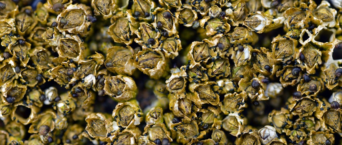 Barnacles, Mussels, Snails - Rocky Intertial Acadia Maine
Barnacles, periwinkles, and blue mussels crowded together on exposed granite — this is the intertidal zone of Acadia National Park, Maine, and few ecological communities on the Atlantic coast are as rugged, competitive, or quietly dramatic as this one.
Acadia's Intertidal
The rocky coastline of Acadia National Park along Mount Desert Island represents some of the most studied and celebrated intertidal habitat in North America. Shaped by some of the most extreme tidal ranges on the U.S. East Coast — regularly swinging six to twelve feet between low and high tide — these rocks are exposed to air, drenched in seawater, baked by summer sun, and locked in winter ice, sometimes within the same day. Life here is organized into distinct horizontal bands, each species staking out the precise elevation it can physiologically tolerate.
The Barnacles
The dominant barnacles in Acadia's intertidal are most likely acorn barnacles — primarily Semibalanus balanoides, the northern rock barnacle, which carpets the mid-to-high intertidal in dense, chalk-white colonies. What appears to be a crusty mineral encrustation is actually a community of animals. Each cone is an individual crustacean — closely related to crabs and shrimp — that has cemented its head permanently to the rock and built a volcano-shaped limestone fortress around itself. When submerged, the plates at the top open and feathery feeding appendages called cirri sweep the water for plankton in rhythmic, raking strokes. When the tide retreats, the plates clamp shut, sealing in moisture and protecting soft tissue from desiccation and predators. A barnacle can survive hours of aerial exposure that would kill most marine invertebrates.
The Periwinkles
The small snails grazing among the barnacles are almost certainly common periwinkles (Littorina littorea), an intertidal species so successful it has become one of the dominant grazers on the entire New England coast. Periwinkles rasp algae and biofilm from rock surfaces using a ribbon of tiny teeth called a radula, and their grazing pressure actually shapes which species of algae and organisms can establish themselves — making them quiet but powerful ecological engineers. They are extraordinarily tolerant of exposure, capable of sealing their shell opening with a tough plate called an operculum and entering a dormant state during low tide. Periwinkles are also, notably, a non-native species introduced from Europe in the 1800s that has thoroughly naturalized into the New England intertidal ecosystem.
The Mussels
The blue mussels (Mytilus edulis) nestled into the barnacle matrix represent the intertidal's master colonizer. Mussels attach to rock and to each other using byssus threads — strong, elastic protein fibers secreted from a gland near the foot — forming dense mats that can eventually outcompete barnacles for space if left unchecked. They are filter feeders, drawing water through their gills and straining out phytoplankton and suspended organic matter with extraordinary efficiency. A single mussel can filter more than a liter of seawater per hour. Their aggregations create habitat for dozens of other small invertebrates — worms, amphipods, small crabs — sheltering within the mussel matrix like a city within a city.
The Competition
What looks like a static rock surface is in ecological terms a slow-motion battlefield. Barnacles, mussels, algae, and periwinkles are in perpetual competition for the most precious intertidal resource — bare rock to settle on. Barnacles colonize open space quickly after disturbance, mussels can overgrow them, sea stars (Asterias forbesi and A. vulgaris) prey heavily on mussels from below at low tide, and winter ice scour periodically resets patches to bare rock and starts the succession over. The ecologist Robert Paine's foundational work on intertidal community structure — including the concept of the keystone species — grew directly out of research conducted in this kind of rocky intertidal habitat.
Seasonality in Maine
In Acadia, the intertidal community shifts with the seasons in ways invisible in warmer climates. Barnacles spawn in late winter and early spring, releasing nauplii larvae into frigid water. By late spring, newly settled barnacle spat — barely visible to the naked eye — dust the rock in a faint haze of white. Summer brings maximum biological activity, predation pressure, and algal growth. Winter strips some of the softer community back and, in hard freeze years, ice rafting physically tears mussel beds and barnacle patches from the rock entirely, creating the disturbance patches that the community then races to recolonize come spring.
Uploaded Oct 10, 2012 by Jason Buchheim username:odyssey copyright
17,708px by 7,547px, 0.13 Gigapixels
| Unmounted | Acrylic Museum Mount |
| Purchase Prints | Matte | Glossy | Lustre | Metalic | Deep Glossy | Deep Glossy |
| 12" x 28" | | | | | | |
| 18" x 42" | | | | | | |
| 24" x 56" | | | | | | |
VIEW OPTIONS please select the approximate angle of view of the image
Flat 1° 10° 45° 90° 170°
Sphere 45° 90° 180° 270° 360°
Odyssey Expeditions Panoram.io VR billboard style
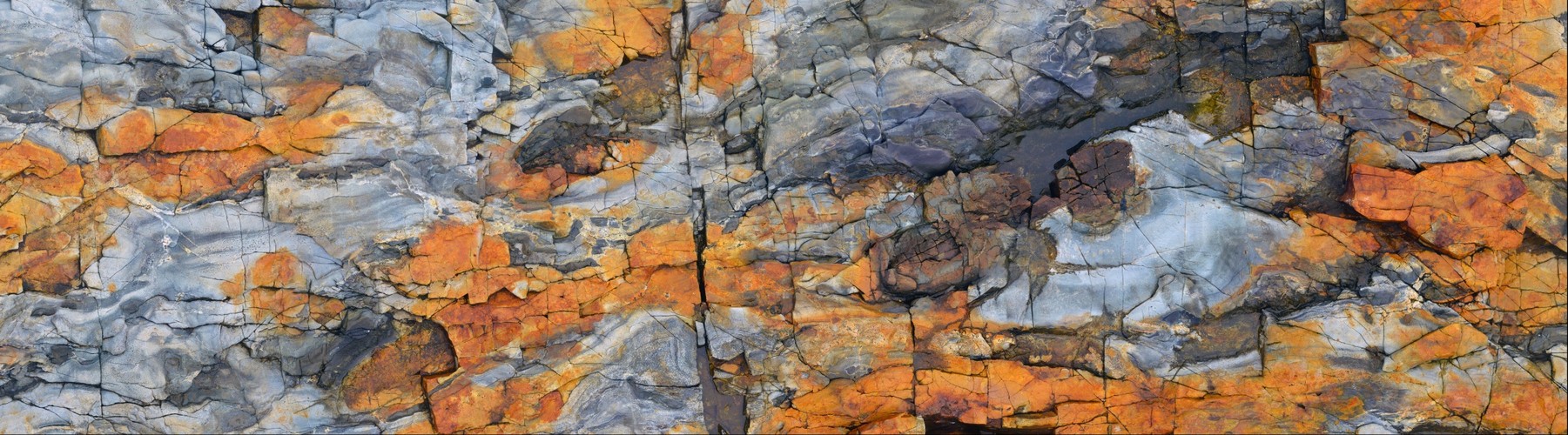 High Rocky Intertidal- Acadia, Maine
The beautiful rocks on the Acadia National Park seashore. Taken straight down, handheld, walking along the rock- two rows of 8 shots each (so, this shot was not taken from a central point). Shot with a Nikon D800 and a 50mm lens.
Uploaded Oct 6, 2012 by Jason Buchheim username:odyssey copyright
35,868px by 9,958px, 0.36 Gigapixels
| Unmounted | Acrylic Museum Mount |
| Purchase Prints | Matte | Glossy | Lustre | Metalic | Deep Glossy | Deep Glossy |
| 12" x 43" | | | | | | |
| 18" x 65" | | | | | | |
| 24" x 86" | | | | | | |
| 30" x 108" | | | | | | |
VIEW OPTIONS please select the approximate angle of view of the image
Flat 1° 10° 45° 90° 170°
Sphere 45° 90° 180° 270° 360°
Odyssey Expeditions Panoram.io VR billboard style
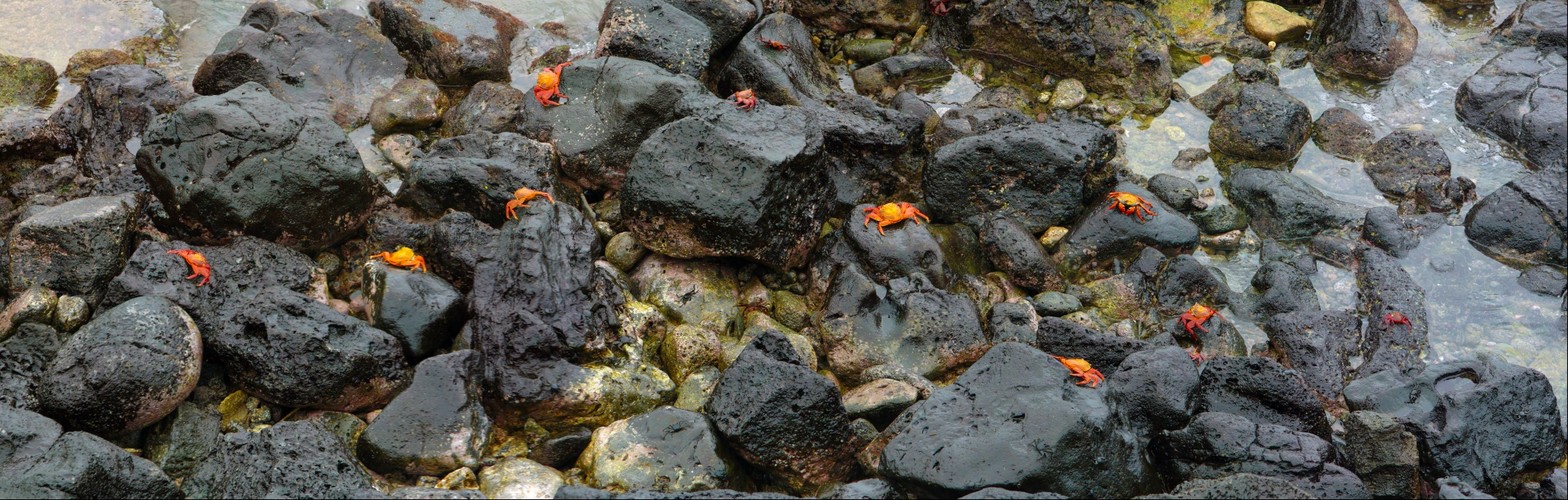 Galapagos Intertidal
Crabs on rocks at Galapagos
Uploaded Dec 27, 2009 by Jason Buchheim username:odyssey copyright 2009
17,407px by 5,552px, 0.10 Gigapixels
| Unmounted | Acrylic Museum Mount |
| Purchase Prints | Matte | Glossy | Lustre | Metalic | Deep Glossy | Deep Glossy |
| 12" x 38" | | | | | | |
| 18" x 56" | | | | | | |
VIEW OPTIONS please select the approximate angle of view of the image
Flat 1° 10° 45° 90° 170°
Sphere 45° 90° 180° 270° 360°
Odyssey Expeditions Panoram.io VR billboard style
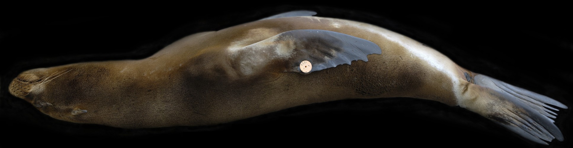 Galapagos Sea Lion Sleeping
Latin Name Zalophus wollebaeki
Conservation Status Vulnerable
Location Galapagos Islands
Colour Brown
Length 150 - 250 cms (59 - 98 inches)
Weight 50 - 400 Kgs (110 - 880 lbs)
Main Characteristics
Galapagos Sea Lions are one of the most conspicuous and numerous marine mammals on the Galapagos Islands. They have a body length between 150 and 250 cms (59 - 98 inches) and they weigh between 50 and 400 Kgs (110 - 880 lbs), males being much larger than females.
Males are coloured brown, females tend to be a lighter tan and juveniles are coloured chestnut brown. Their bodies are streamline and they have well developed fore flippers which they use to propel themselves through the water. They can control their hind flippers independently which enables them to move around more effectively on land.
When males reach puberty they begin to develop a raised forehead and sometimes their hair is lighter coloured on their crest.
Habitat
Galapagos Sea Lions are found on the islands of the Galapagos Archipelago. They spend a lot of their time swimming in the ocean but while on land they prefer sandy beaches and flat rocky areas that have plenty of shade and tidal pools. While at sea they will rarely venture further than 16 Kms (10 miles) from the coast.
Females gather in colonies of approximately 30 individuals and each colony is dominated by one bull. He will hold his territory for a short time before he is displaced by another bull. Bulls that are not dominating a colony will gather together in a bachelor group.
Diet
Galapagos Sea Lions mainly feed upon fish, squid, octopus and crustaceans.
Breeding
Galapagos Sea Lions breed between May and January and mating usually occurs in the water. Males hold their territories for 10 days - 3 months and during this time they aggressively defend it.
After a gestation period of approximately 11 months, females give birth to 1 pup. When the pups are born they weigh approximately 6 Kgs (13.2 lbs) and they are approximately 75 cms (29.5 inches) long. The pups are attended continuously by their mothers for 6 - 7 days after they are born, then the females have to go to sea to feed themselves, returning to their pups at night.
When the pups reach 1 - 2 weeks old they will venture into the water and start to learn how to swim. They are weaned when they reach 11 - 12 months old but because of the long breeding season and the length of time pups are cared for by their mothers, there are dependent pups on the rookeries all year round.
Predators
The main predators of Galapagos Sea Lions are sharks and killer whales. Dogs are also known to prey upon pups.
Interesting Facts
Galapagos Sea Lions are also known as:Pagos Sea Lion
Nikon D200 handheld 9 shots, stitched with PtGui. Brick floor carefully removed in Photoshop leaving a black background.
Uploaded Oct 15, 2009 by Jason Buchheim username:odyssey copyright 2009
18,459px by 4,771px, 0.09 Gigapixels
| Unmounted | Acrylic Museum Mount |
| Purchase Prints | Matte | Glossy | Lustre | Metalic | Deep Glossy | Deep Glossy |
| 12" x 46" | | | | | | |
VIEW OPTIONS please select the approximate angle of view of the image
Flat 1° 10° 45° 90° 170°
Sphere 45° 90° 180° 270° 360°
Odyssey Expeditions Panoram.io VR billboard style
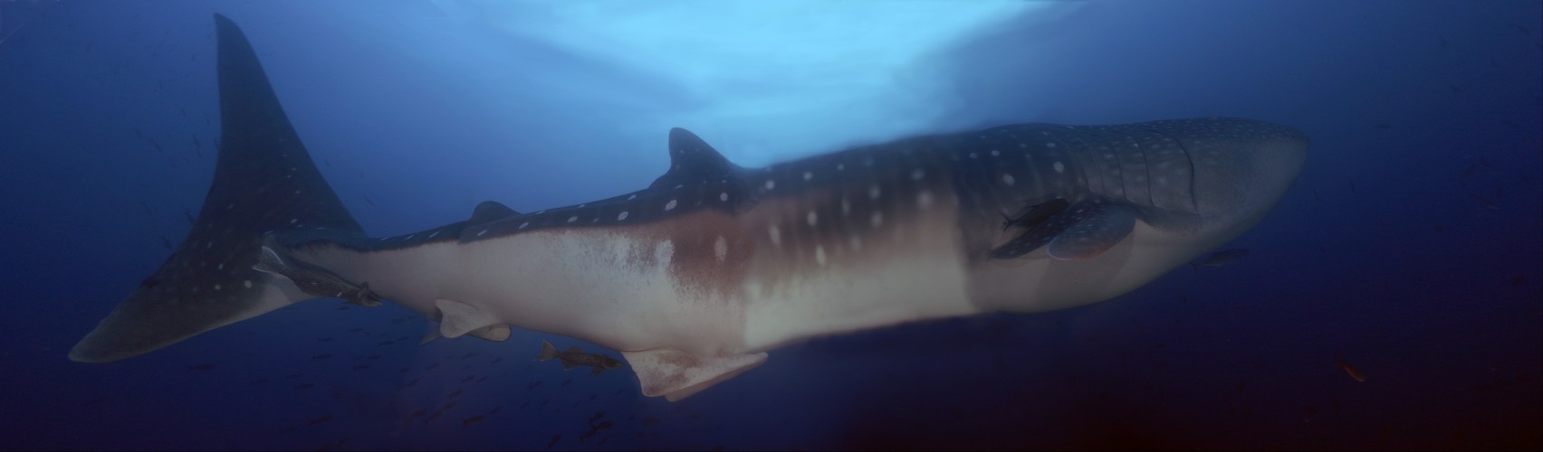 Gigashark Whale Shark Galapagos
So I decided to take a panoramic shot of the worlds largest fish as we swam together at two knots up current in 100 feet of water. Somehow, while holding a large dual flash camera and kicking, kicking, kicking to keep up, I was able to grab 7 frames of this 'Gigashark' as we swam away from the 'Theater' at Darwin's Arch. Darwin Island, Galapagos. Unfortunately, two of the seven frames did not focus... And you don't get any re-try's of this, so I publish it anyways. I really wish my autofocus had been turned off, it just could not find enough contrast on the whale shark midsection's white underside.
I will have to go back and try again someday. It was a thrill and more trying. You literally have to strap yourself to the rocks to stay put in the high currents and wait for these amazing creatures to come out of the blue. Then you release your reef hook and swim out into the blue to meet your new friend.
Whale sharks are baleen feeders, they eat plankton, filtering it out of the water column. They are the largest of all fishes, up to 50 feet long. I believe this one was surely more than 35 feet. Notice the size of the Galapagos shark by its ventral fins.
Uploaded Oct 14, 2009 by Jason Buchheim username:odyssey copyright 2009
13,630px by 4,000px, 0.05 Gigapixels
| Unmounted | Acrylic Museum Mount |
| Purchase Prints | Matte | Glossy | Lustre | Metalic | Deep Glossy | Deep Glossy |
| 12" x 41" | | | | | | |
VIEW OPTIONS please select the approximate angle of view of the image
Flat 1° 10° 45° 90° 170°
Sphere 45° 90° 180° 270° 360°
Odyssey Expeditions Panoram.io VR billboard style
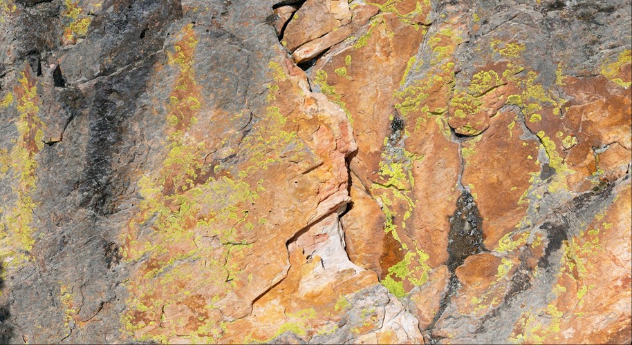 Indians Eye to Eye (lichen covered boulder)
This lichen covered boulder is in the backcountry of Snowmass, Colorado, on Burnt Mountain. I have been thinking of photographing this site for over a year and finally made it out with the Gigapan mount and tripod way out in the wilderness. Actually, the day before, I was here trying to photograph this by hand. I was concentrating really hard on lining up each shot to make a handheld Gigapan. I was about half way through when I heard some snowboarder on the hill above me yelling "hey, photographer, enough with the photos of the rock, move out of the way already" Well, I wasn't done, and I did not want to loose my 'nodal point' position. Besides, we were in the backcountry wilderness, there are a million different routes to go. But they wanted to go right where I was standing. I told them to go around. They did not understand why I would not just move. I understand that it is not obvious to a layman why moving would ruin my shot in progress. I held my ground. The first fellow snowboards by me no problem. The second fellow PUNCHES me as he is going by. Luckily it was a weak punch, but it did throw him off balance and he crashes landing upside down in a tree well below me. Well, I did not escalate the situation further beyond calling him an mild expletive. He dug himself out and did not crawl back up to my little spot on the planet.
Here is another view of this boulder from the year before (lots of snow) http://share.gigapan.org/viewGigapan.php?id=3124
I shot this as a High Dynamic Range 3 images per location, but I could not find stitching software that would stitch it. PtGUI would align it great but would never stitch it, it just halted upon stitching. Autopano Giga kept crashing... So this is not the HDR version, and the Gigapan Stitcher performed marvelously.
Personally I feel this image has a painterly feeling, but the painter would have to be Jackson Pollack. Its very abstract, with lots of random splashes of color about.
It seems that the lichens like to live in the moister regions of the boulder, in the cracks on non-vertical faces. There definitely is a gradient of the lichen species with the amount of water that can be held onto. The fleshier lichens are in the cracks. Its amazing to think that this is the thickness of the life on the surface of the earth at this place, just a thin crusting between hard rock and atmosphere!
Lichens (IPA: /ˈlaɪkən/) are composite organisms consisting of a symbiotic association of a fungus (the mycobiont) with a photosynthetic partner (the photobiont or phycobiont), usually either a green alga (commonly Trebouxia) or cyanobacterium (commonly Nostoc). The morphology, physiology and biochemistry of lichens are very different to that of the isolated fungus and alga in culture. Lichens occur in some of the most extreme environments on Earth—arctic tundra, hot deserts, rocky coasts and toxic slag heaps. However, they are also abundant as epiphytes on leaves and branches in rain forests and temperate woodland, on bare rock, including walls and gravestones and on exposed soil surfaces (e.g. Collema) in otherwise mesic habitats. Lichens are widespread and long-lived however, many species are also vulnerable to environmental disturbance, and may be useful to scientists in assessing the effects of air pollution, ozone depletion, and metal contamination. Lichens have also been used in making dyes and perfumes, as well as in traditional medicines.
Stitcher: 0.4.4090 Images: 221 (17 columns by 13 rows) Camera: Panasonic DMC-FZ50 Capture time: 2009-03-28 16:05:33 - 2009-03-08 16:27:41 Aperture: f/11 Exposure: 0.00625 ISO: 100 Focal Length (35mm equiv): 420.0mm Horizontal Overlap: 14.3 to 19.7 Vertical Overlap: 15.8 to 23.8 Computer Stats: 2046 MB RAM 4 CPUs Total Time: 2:28:39 (0:40 per picture) Alignment: 24:01, Projection: 9:09 Blending 1:55:28
Uploaded Apr 1, 2009 by Jason Buchheim username:odyssey copyright 2009
51,815px by 28,355px, 1.47 Gigapixels
| Unmounted | Acrylic Museum Mount |
| Purchase Prints | Matte | Glossy | Lustre | Metalic | Deep Glossy | Deep Glossy |
| 12" x 22" | | | | | | |
| 18" x 33" | | | | | | |
| 24" x 44" | | | | | | |
| 30" x 55" | | | | | | |
| 36" x 66" | | | | | | |
VIEW OPTIONS please select the approximate angle of view of the image
Flat 1° 10° 45° 90° 170°
Sphere 45° 90° 180° 270° 360°
Odyssey Expeditions Panoram.io VR billboard style
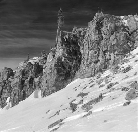 Burnt Mountain Cliffband, Snowmass Colorado
Lichen covered rocks at the top of Burnt Mountain, Snowmass, Colorado
Uploaded Mar 1, 2009 by Jason Buchheim username:odyssey copyright 2009
18,729px by 17,795px, 0.33 Gigapixels
| Unmounted | Acrylic Museum Mount |
| Purchase Prints | Matte | Glossy | Lustre | Metalic | Deep Glossy | Deep Glossy |
| 12" x 13" | | | | | | |
| 18" x 19" | | | | | | |
| 24" x 25" | | | | | | |
| 30" x 32" | | | | | | |
| 36" x 38" | | | | | | |
VIEW OPTIONS please select the approximate angle of view of the image
Flat 1° 10° 45° 90° 170°
Sphere 45° 90° 180° 270° 360°
Odyssey Expeditions Panoram.io VR billboard style
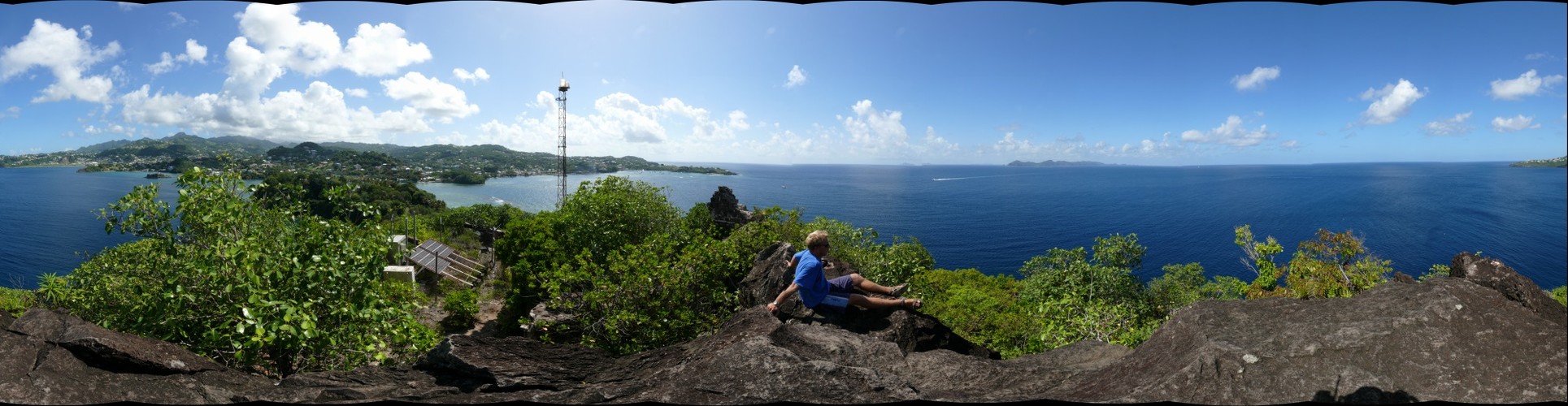 Fort Rock, St Vincent
Its a rock, its a fort, no its a fort, no its a rock, its Rock Fort, no its Fort Rock, Fort Douvenette, St Vincent. Notice that the canons are pointed toward St Vincent. Hmmm. How hard must it be to get the canons on top of the rock?
Uploaded Oct 3, 2008 by Jason Buchheim username:odyssey copyright 2008
31,950px by 8,280px, 0.26 Gigapixels
| Unmounted | Acrylic Museum Mount |
| Purchase Prints | Matte | Glossy | Lustre | Metalic | Deep Glossy | Deep Glossy |
| 12" x 46" | | | | | | |
| 18" x 69" | | | | | | |
| 24" x 93" | | | | | | |
VIEW OPTIONS please select the approximate angle of view of the image
Flat 1° 10° 45° 90° 170°
Sphere 45° 90° 180° 270° 360°
Odyssey Expeditions Panoram.io VR billboard style
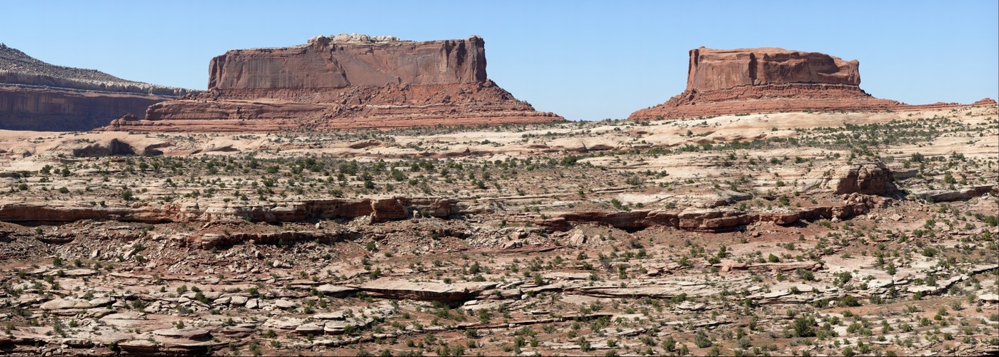 Monitor vs Merrimac, in perpetual static battle, Canyonlands, Utah
This is a technically perfect Gigapan of the Monitor and Merrimac rocks in Canyonlands, Utah. The stitching worked 100% with no ghosting or errors, the exposure is perfect throughout the image. Shot at 750mm 35mm equivalent so its super high resolution. Hope you enjoy!!!
Uploaded Apr 27, 2008 by Jason Buchheim username:odyssey copyright 2008
62,576px by 22,365px, 1.40 Gigapixels
| Unmounted | Acrylic Museum Mount |
| Purchase Prints | Matte | Glossy | Lustre | Metalic | Deep Glossy | Deep Glossy |
| 12" x 34" | | | | | | |
| 18" x 50" | | | | | | |
| 24" x 67" | | | | | | |
| 30" x 84" | | | | | | |
| 36" x 101" | | | | | | |
VIEW OPTIONS please select the approximate angle of view of the image
Flat 1° 10° 45° 90° 170°
Sphere 45° 90° 180° 270° 360°
Odyssey Expeditions Panoram.io VR billboard style
 Baldy Mountain on a very windy day, Snowmass, Colorado
A very very windy day on top of Baldy Mountain, at 13,300 feet. My friend Ed and I hiked up here so he could fly down on his speed kite, but it was far too windy, blowing at 50mph (it was calm when we left a couple hours before, and from 6000 feet lower...) I had to wedge the tripod into the peak rock pile to keep the gigapan unit from blowing away, then we went and hid from the wind under the snowbank. Taking the glove off momentarily to connect the Gigapan power and the thumb screw on the camera was painful. You cant see the aspect we skied down, it is from the top of the large mound behind us. It was steep and solid, a wonderful backcountry day, although Ed did no flying. The Gigapan unit caught lift at the end of the serious, causing the camera to point to the sky and missing the final four columns. The stitcher still decided to join them but four columns are indeed missing.
Uploaded Mar 29, 2008 by Jason Buchheim username:odyssey copyright 2008
120,963px by 16,692px, 2.02 Gigapixels
| Unmounted | Acrylic Museum Mount |
| Purchase Prints | Matte | Glossy | Lustre | Metalic | Deep Glossy | Deep Glossy |
| 12" x 87" | | | | | | |
| 18" x 130" | | | | | | |
| 24" x 174" | | | | | | |
| 30" x 217" | | | | | | |
| 36" x 261" | | | | | | |
VIEW OPTIONS please select the approximate angle of view of the image
Flat 1° 10° 45° 90° 170°
Sphere 45° 90° 180° 270° 360°
Odyssey Expeditions Panoram.io VR billboard style
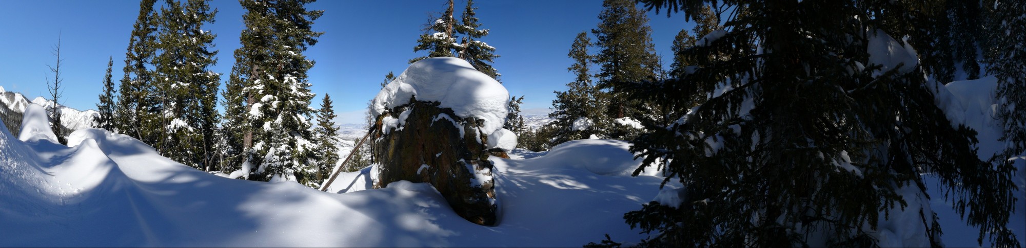 Secret Rock Garden Powder Stash, Snowmass, Colorado
Uploaded Feb 11, 2008 by Jason Buchheim username:odyssey copyright 2008
15,000px by 3,637px, 0.05 Gigapixels
| Unmounted | Acrylic Museum Mount |
| Purchase Prints | Matte | Glossy | Lustre | Metalic | Deep Glossy | Deep Glossy |
| 12" x 49" | | | | | | |
VIEW OPTIONS please select the approximate angle of view of the image
Flat 1° 10° 45° 90° 170°
Sphere 45° 90° 180° 270° 360°
Odyssey Expeditions Panoram.io VR billboard style
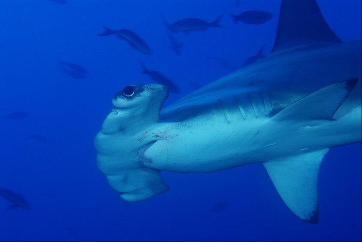 Scalloped Hammerhead Shark, Cocos Island, Costa Rica
The scalloped hammerhead (Sphyrna lewini) is one of the ocean's most iconic and socially complex sharks — and Cocos Island, Costa Rica sits at the heart of their world.
Why Cocos Island
Rising from the deep Pacific roughly 550 km southwest of mainland Costa Rica, Cocos Island (Isla del Coco) is one of the most remote and biologically rich marine environments on Earth. Its nutrient-rich upwellings, driven by converging Pacific currents, create a perpetual buffet that draws hammerheads in extraordinary numbers. The island is a UNESCO World Heritage Site and one of the top scuba diving destinations on the planet — largely because of these sharks.
The Schools
Scalloped hammerheads are unusual among sharks in their tendency to form large aggregations. At Cocos, divers routinely encounter schools of dozens to several hundred individuals swirling in slow, hypnotic formations along seamounts and cleaning stations like Dirty Rock and Alcyone. These gatherings are predominantly females, and researchers believe the schooling behavior is linked to social hierarchy, mating selection, and the use of the seamounts as navigational waypoints during long oceanic migrations.
The Hammer
The distinctive cephalofoil — that wide, flattened head — is far more than an unusual silhouette. It is densely packed with electroreceptors called ampullae of Lorenzini, giving scalloped hammerheads an extraordinarily sensitive ability to detect the faint electrical fields produced by prey buried in sand or hiding in reef crevices. The wide-set eyes also provide nearly 360° of vision, with just two small blind spots directly in front and behind.
Diet and Behavior
At Cocos they feed primarily on fish, squid, octopus, and stingrays. They are active, strong swimmers that undertake deep daily dives — sometimes exceeding 500 meters — likely to cool their bodies and hunt in the mesopelagic zone before returning to warmer, shallower water.
Conservation Status
Scalloped hammerheads are listed as Critically Endangered on the IUCN Red List. Their fins are among the most valued in the shark fin trade, and their slow reproductive rate — bearing live young (viviparous) in litters of 15–30 pups after a roughly 9–12 month gestation — makes population recovery painfully slow. Costa Rica's 22-nautical-mile no-fishing exclusion zone around Cocos offers meaningful protection, and the island's remoteness has helped it remain one of the last places on Earth where witnessing a large hammerhead school is still possible.
Uploaded Jan 24, 2008 by Jason Buchheim username:odyssey copyright 2008
7,744px by 5,184px, 0.04 Gigapixels
| Unmounted | Acrylic Museum Mount |
| Purchase Prints | Matte | Glossy | Lustre | Metalic | Deep Glossy | Deep Glossy |
| 12" x 18" | | | | | | |
VIEW OPTIONS please select the approximate angle of view of the image
Flat 1° 10° 45° 90° 170°
Sphere 45° 90° 180° 270° 360°
Odyssey Expeditions Panoram.io VR billboard style
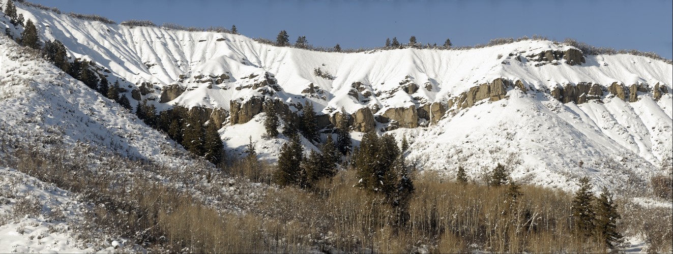 Snowmass Cliff With Snow, Superzoom 750mm detail
nice detail in the rocks on the cliff
Uploaded Jan 16, 2008 by Jason Buchheim username:odyssey copyright 2008
39,561px by 14,948px, 0.59 Gigapixels
| Unmounted | Acrylic Museum Mount |
| Purchase Prints | Matte | Glossy | Lustre | Metalic | Deep Glossy | Deep Glossy |
| 12" x 32" | | | | | | |
| 18" x 48" | | | | | | |
| 24" x 64" | | | | | | |
| 30" x 79" | | | | | | |
| 36" x 95" | | | | | | |
VIEW OPTIONS please select the approximate angle of view of the image
Flat 1° 10° 45° 90° 170°
Sphere 45° 90° 180° 270° 360°
Odyssey Expeditions Panoram.io VR billboard style
All images uploaded to and reside only at Gigapan®.com. Image copyrights by respective photographers.
This site does not copy or store any images and only provides the viewer KRPANO panorama viewing software, necessary configuration XML and proxy using the public Gigapan® API.